ESM 263 GIS Assignments
This class was intended to build a working knowledge of GIS theory and practice in a single quarter. GIS, or Geographic Information Systems, are used to visualize, analyze, and interpret geographic data. Three of my assignments for this class are displayed below.
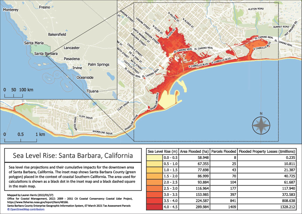
Assignment 2
This map reveals how sea-level rise will impact downtown Santa Barbara spatially and financially. Created with QGIS.
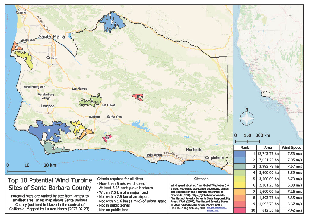
Assignment 3
This map highlights the top ten potential sites for wind turbines in Santa Barbara County, based on a multi-criteria analysis. The ten sites listed meet all criteria and are ranked by area, with larger sites receiving higher ranking. Created with QGIS.
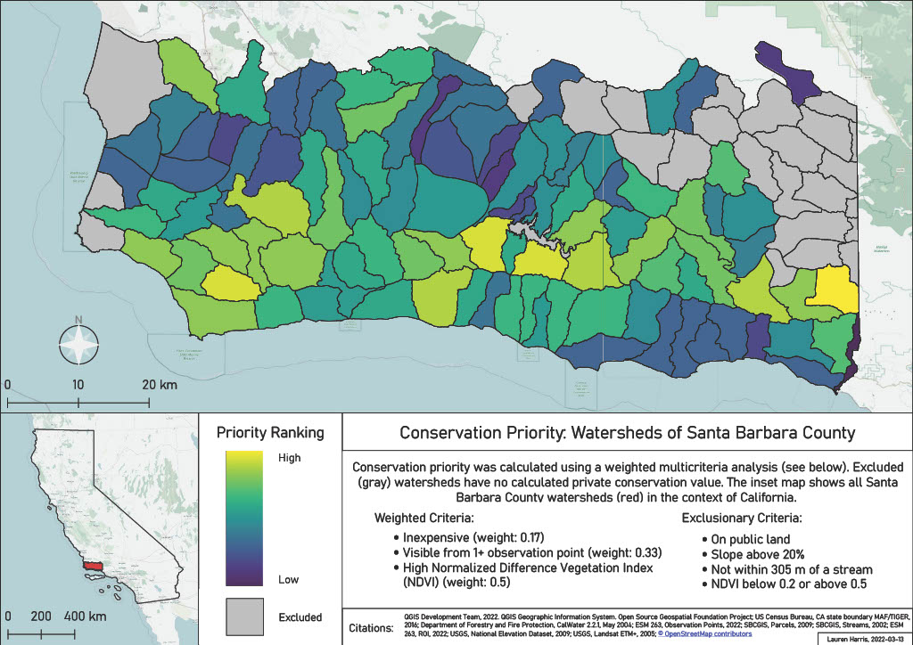
Assignment 4
This map displays highest priority watersheds for conservation in Santa Barbara County based on these factors: cost, visibility, NDVI, land ownership, slope, and distance from a stream. Created with QGIS.